

Roadmap by Architect Rahul Mehta (Director, Association for R and D of Sustainable Cities)
This is with reference to the Draft EV Policy that was recently announced by the Government of Gujarat. It is indeed a visionary step to promote the use of EVs in the state, which is well known as the future technology. It will improve air quality in our cities and help the state and country meet our commitments in lowering GHG emissions.
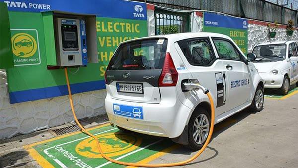
One of the essential factors for EV promotion is the availability of reliable EV charging infrastructure. When charging stations are available throughout the towns and cities, including important highways across the state, it creates an enabling environment. It encourages more people to select EV as their choice of transport.
The developed countries that are promoting EV charging infrastructure are doing so by undertaking a series of analysis like:
Average travel distance of an EV after a single charge.
The number of EVs is expected to increase in the coming decade (bikes and cars), average vehicle charging time, etc.
In order to promote EV to its full potential in Gujarat, it is required that a network of charging stations is laid out across the state after conducting due studies required in this area. This will prove to be crucial in the long term success of EV. In order to facilitate this, GIS (Geo-analytics) and related technologies can be leveraged for conduction the following analyses:
- Planning of charging infrastructure (Capacity and Location)
- Real-time information on the availability of charging docks
- Information and direction of nearest charging infrastructure
- Analysis of capacity utilisation and usage pattern
- Impact and benefit analysis of EV policy
Planning
Geo-processing tools available in GIS technology can help identify site selection based on parameters like:
- Available land parcel size and shape to meet the need of charging station
- Accessibility and approach to charging station
- Expected density in EV owners surrounding area of charging station (It can be combination of assumption and actual registration addresses of EVs)
- The minimum distance between the two-charging stations.
- All kinds of documentation like plans, drawing, infrastructure details, and other legal documents etc., can be also be tagged to each infrastructure on map/dashboard so that systems can act as a single point of access as well single source of truth for the entire charging infrastructure planning till operationalisation. We can add any other suitable parameters in line with guidance by the government or subject matter experts.
Availability Monitoring and Information Dissemination
- Integrating IoT devices or control systems of charging infrastructure with GIS systems will help visualize the real-time status of each infrastructure on the map. This information can be rendered through mobile app and web portals to benefit Vehicle owners/drivers.
- A mobile app will show the nearest EV charging station matching with vehicle type/Batter type in vehicle.
- On drilling down, it would show the availability of a matching charging dock.
- In case of 100% occupancy, it would show likely waiting time or likely available slot.
- If required, booking of the slot also can be enabled.
- The shortest route on a map can be displayed to reach the nearest charging station with a matching dock.
GIS-based Analysis.
- GIS-based analysis (Geo-analytics) can effectively give the insights and location-based intelligence to get meaningfully actionable for overall improvement. E.g. Usage/capacity utilisation analysis of charging infrastructure, including different types of charging docks.
- Time series analysis (Variation of capacity utilizations based at a different time of the day) to predict the peak demand and time slot for this demand.
- Average waiting time, peak waiting for time and time series-based waiting time trend analysis to get insights on infrastructure augmentation requirements.
- Linkage of infrastructure utilizations pattern with the density of EV registration in the surrounding area.
- By integrating AQI (Air Quality Index) data of city with EV Density as well as usage pattern to derive the scientific correlation and impact of EV usage on pollution to planning further the awareness campaign/communication as well as fine-tuning the policy further
- The analysis will help the government understand and effectively communicate (along with supporting data) about actual benefits derived from EV policy in reducing pollution.
Benefits of GIS-Based Analysis:
- Optimum usage of Grants to Capital for Infrastructure of EV Charging Station.
- Entire Gujarat can be covered for travelling by EV with the correct location study.
- This would boost EV Making companies set up manufacturing units in Gujarat. Eventually, Gujarat GDP would go up because of this.
- If this happens, it would be the first “Gujarat Model” that other states would likely follow.
- This would boost Gujarat’s Contribution towards Climate Change Policy and Green Energy.
Centre of Excellence can be set up to do Research and analysis and Reports can be submitted by CoE for Potential locations of charging stations that can be given a grant to.
CoE can extend research work about next-generation EV infrastructure like Battery Swapping, Wireless Charging, etc.